Interactive tools
Walk the site and the proposed buildings in 3D.
📦
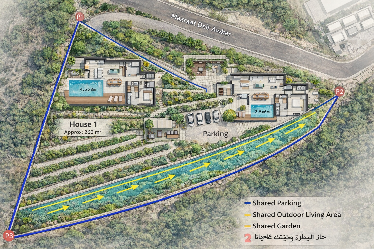
3D Sandbox — House 1
Three.js model of the contemporary house: tower, sunset balcony, S-glass living room, terraced site. Orbit, zoom, inspect.
Open sandbox →🛰️
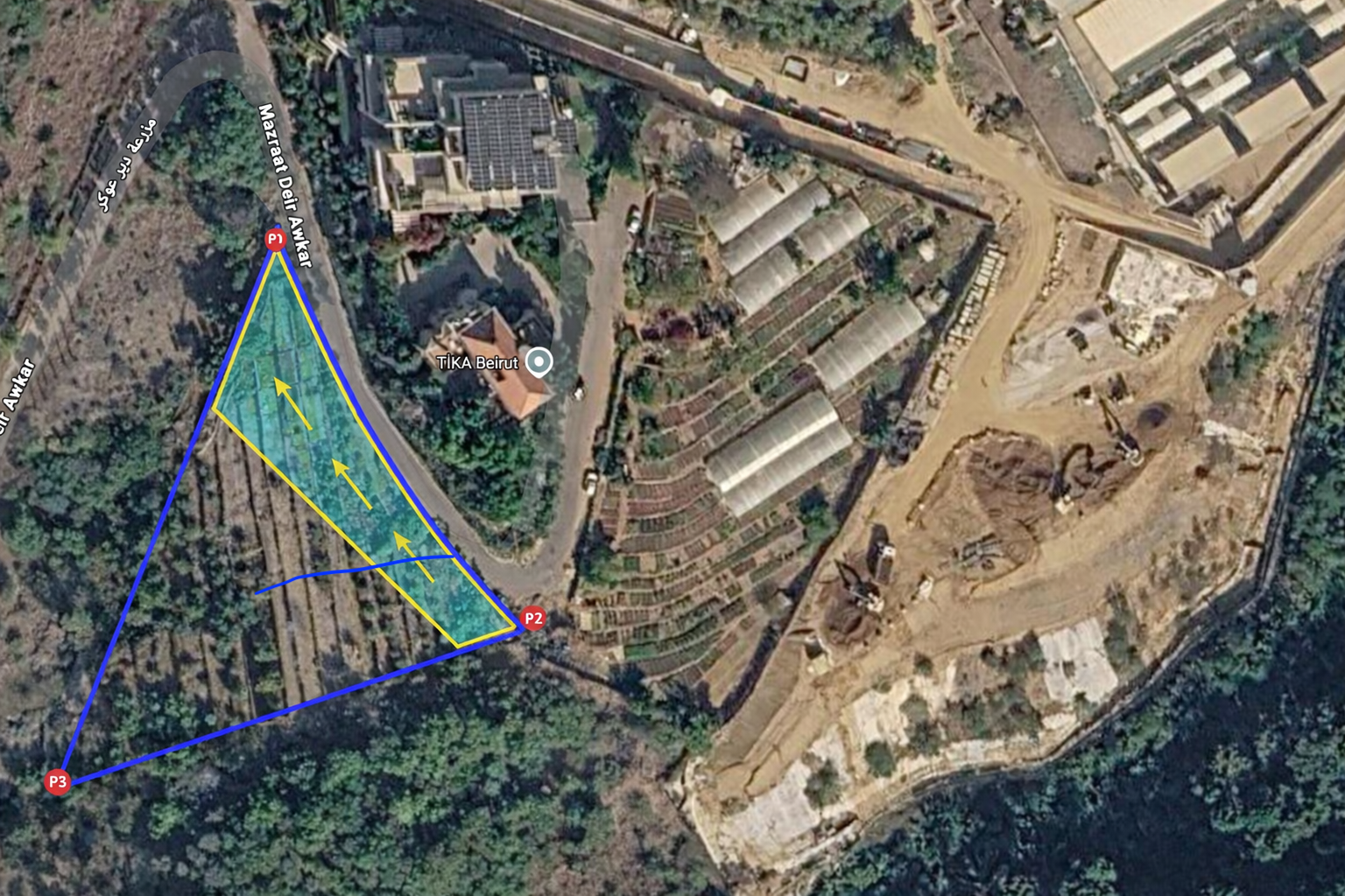
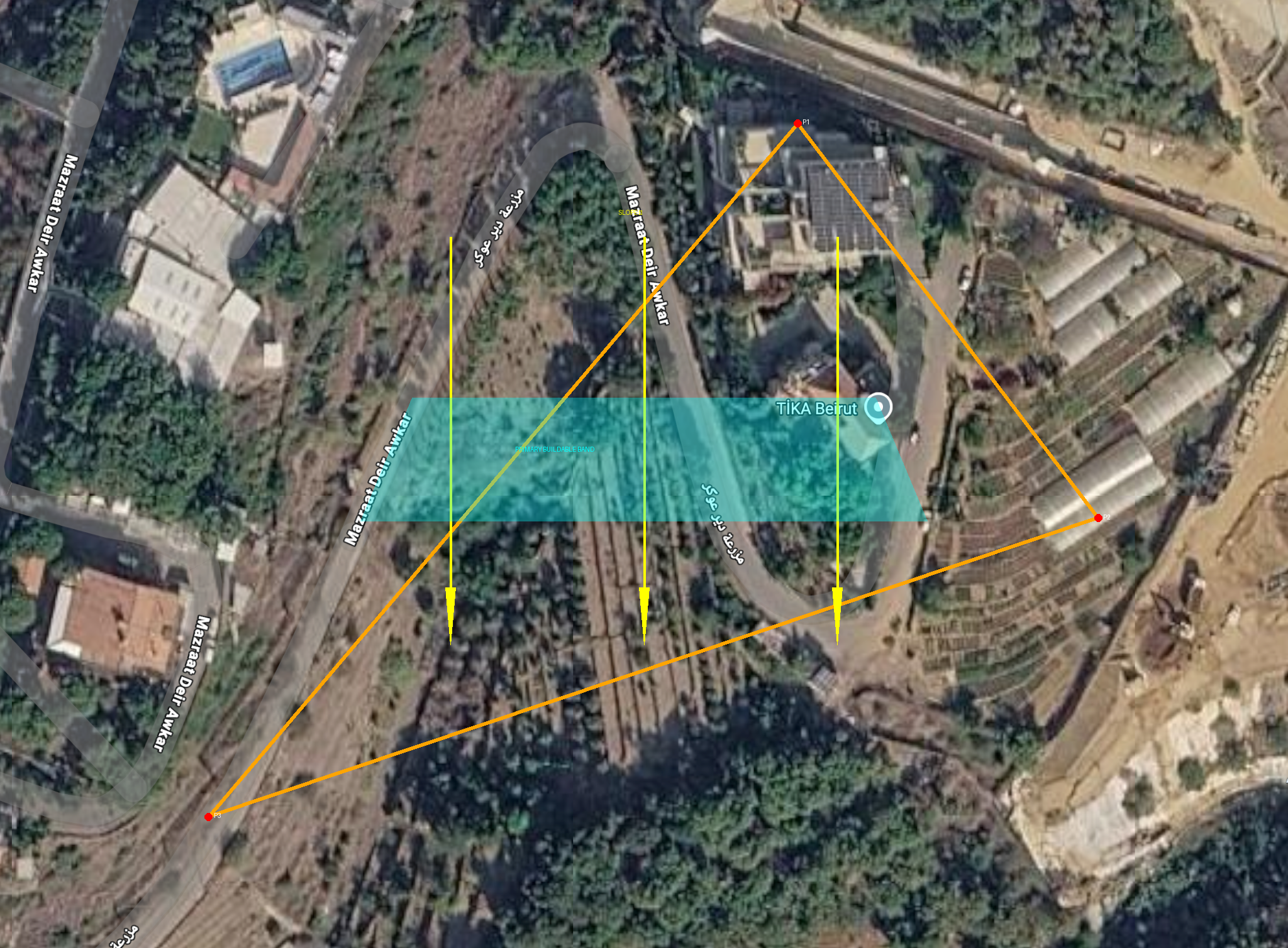
Satellite + 3D house
Real Awkar satellite imagery (Esri) with the 3D house geolocated on the GPS-accurate triangle of plot 319. Bearing and offset live-tunable.
Open map →📄
Architect brief
Full program, site conditions, materials, technical considerations, Lebanon-specific notes, and deliverables expected from the receiving architect.
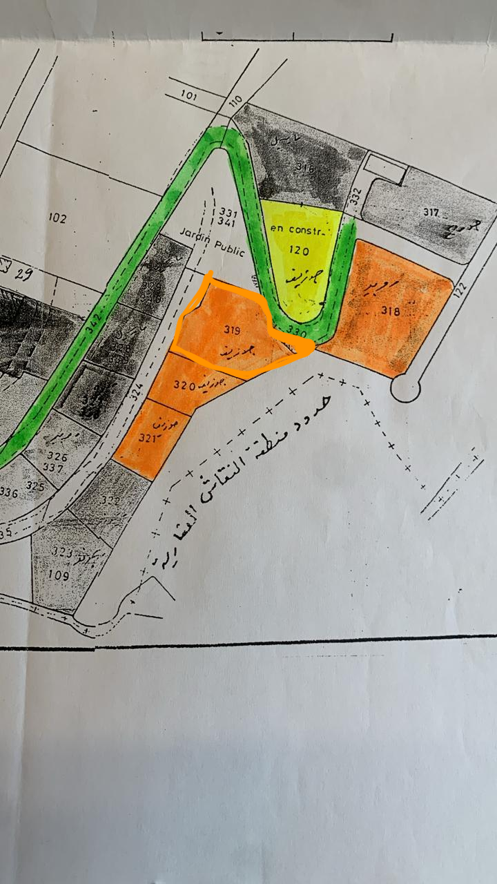
Open brief →Reference photos & renders
Site, cadastre, topography, and earlier massing studies.
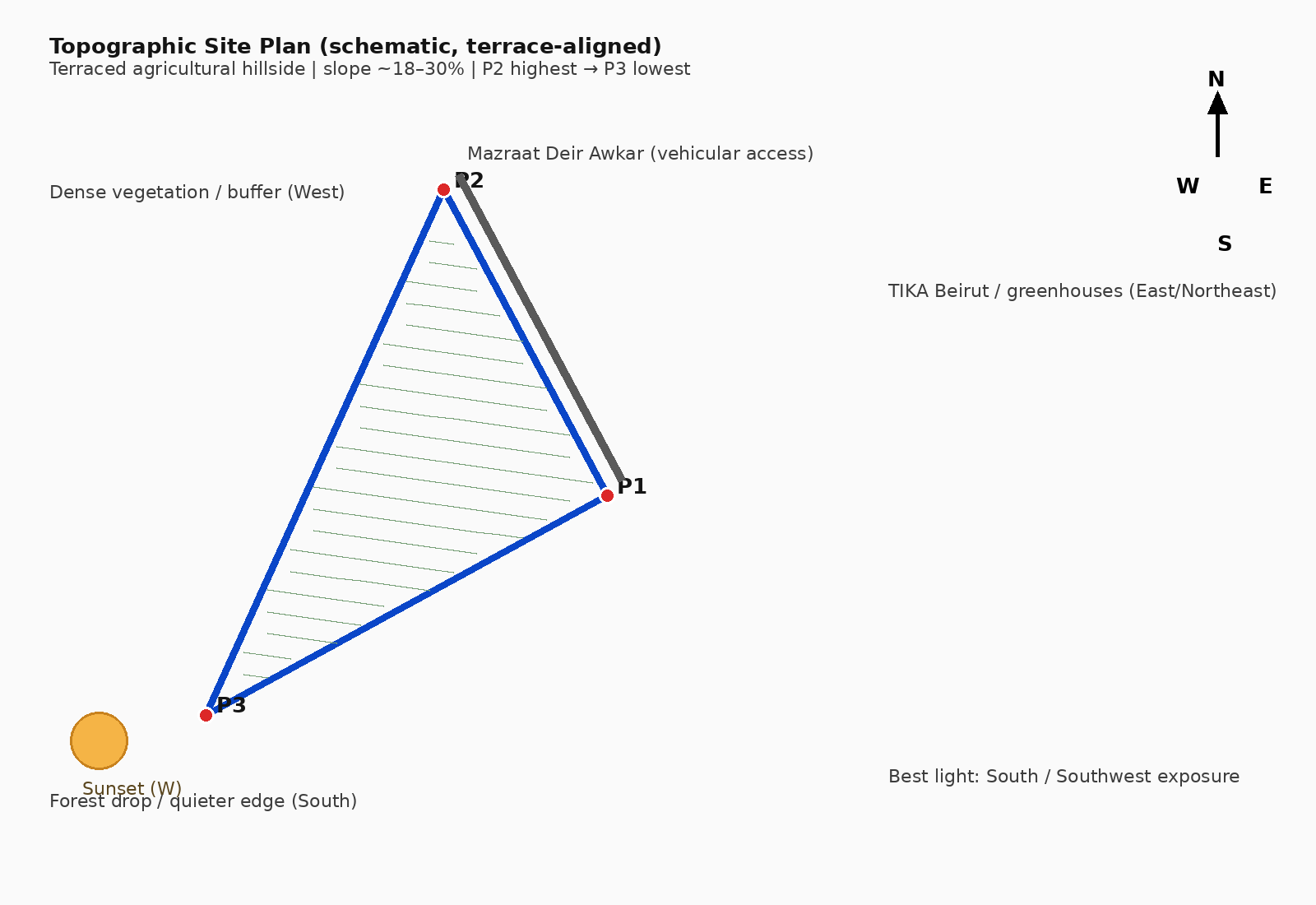
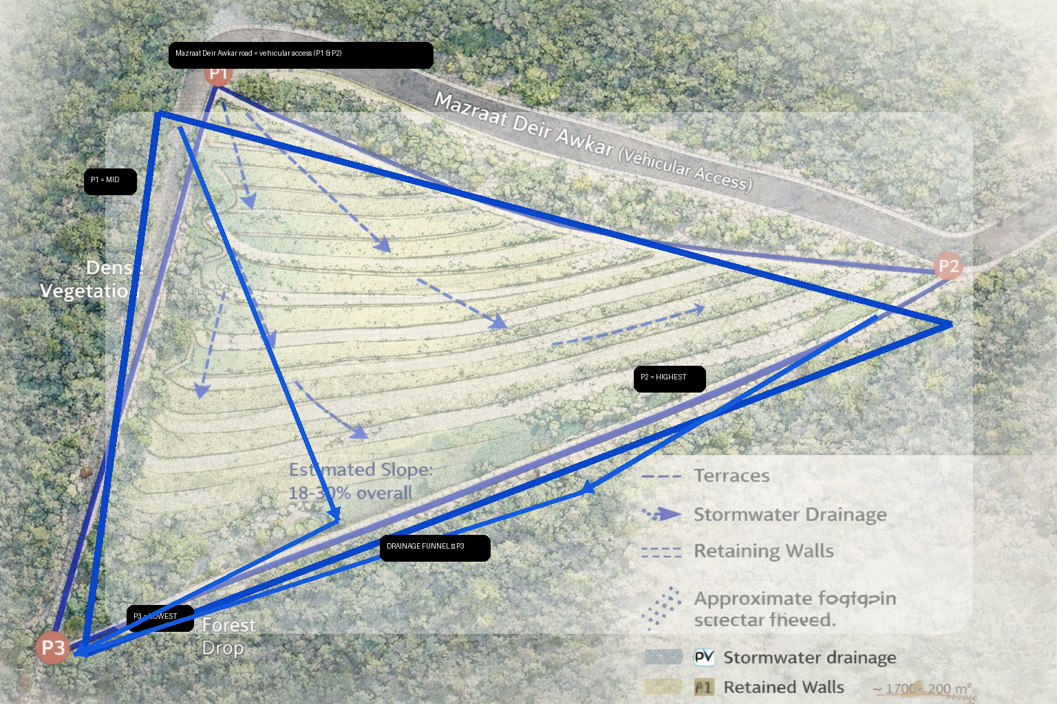


Schematic drawings (SVG)
Pre-architect schematics — site, plans, elevations, sections, axonometric.